Home › Forest Grove
The corridor’s largest town, its oldest infrastructure, and the only one with mapped surface water. All three change how we dig.
Forest Grove is the largest town on the western edge of our service area and, for an excavation crew, the most varied ground we work. Hillsboro Excavation Co. runs jobs here regularly — it is a straight run west on Tualatin Valley Highway from our base, past Cornelius, about 25 miles from downtown Portland at the western edge of the Portland metro area.
What separates Forest Grove from the rest of the corridor is water. The city covers 5.88 square miles, and unlike Cornelius, Banks, or North Plains — which the census records as entirely land — roughly 0.14 square mile of Forest Grove is surface water. That is a small number on paper and a large one on a job site. Where there is mapped water there are drainage ways, seasonal high water, and setback rules, and excavation near any of it is a different job than digging on a dry inland lot.
Forest Grove is one of the oldest settlements in the Tualatin Valley. The Atfalati band of the Kalapuya lived on these plains long before Euro-American settlement; Alvin T. and Abigail Smith arrived over the Oregon Trail in 1841 to a place then called West Tualatin Plain, and the town was platted in 1850. It grew into a farm town and is now largely a commuter town for the Portland metro.
That long history is the practical fact that shapes our work here. Neighborhoods laid out generations ago have utility runs that are older, shallower, and less accurately mapped than anything in a modern subdivision. Mature trees — Forest Grove is home to one of the largest Giant Sequoias in Oregon — mean root systems that have had a century to spread under lawns, driveways, and service lines. When we trench an older Forest Grove property we treat the locate ticket as the starting point rather than the final word, and we pothole by hand where the drawings and the dirt disagree.
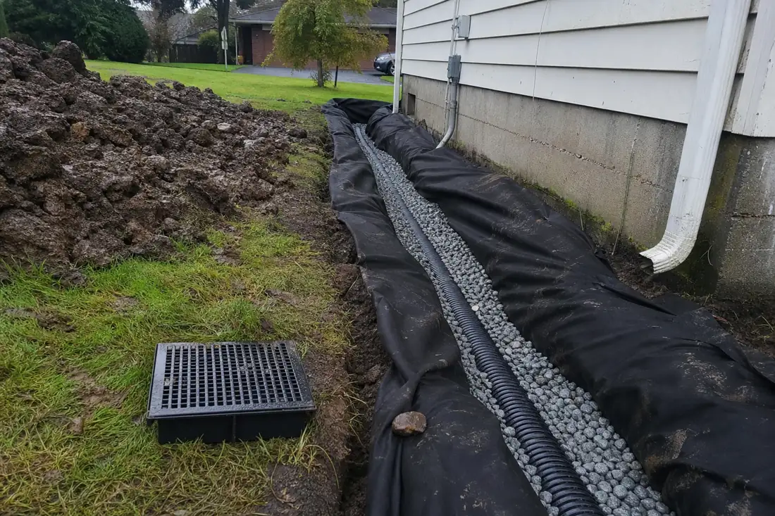
On properties near the mapped waterways, three things change: the water table sits higher for more of the year, the soil stays plastic longer into spring, and the permitting picture gets stricter because runoff has somewhere to go. We plan those jobs around the season instead of forcing them, and we build erosion control to hold up under real winter flow, not just to satisfy a checklist on the day of inspection.
Forest Grove generates a broader mix of work than the smaller towns west of us, because it has both established in-town neighborhoods and rural acreage at its edges:
Older Forest Grove properties frequently need two of these at once — a trenching job that turns out to need drainage, or a site prep that uncovers a failed grade from decades ago. We scope the whole picture rather than quoting the one piece you called about. See our full range of excavation services.
All of this is handled by the same Hillsboro excavation contractor crew year-round. Forest Grove sits in Washington County, so the framework is the one we work under daily: city and county permitting for grading and utility work, Clean Water Services erosion-control requirements on ground-disturbing sites, and an 811 locate before any dig. On properties near mapped water, expect erosion control to be scrutinized more closely than on a dry inland lot — which is exactly why we install it properly the first time instead of reacting to a red tag.
Forest Grove spans established in-town neighborhoods and rural acreage, so the work varies more here than anywhere west of Hillsboro. Each excavation service below covers what the job involves and what drives its price.
Forest Grove has mapped surface water and century-old properties, which changes two jobs enough to warrant their own pages. For the rest, see our Hillsboro excavation overview:
Older Forest Grove properties often need more than one of these at once. Our excavation crew scopes the whole picture rather than quoting one piece.
All Forest Grove services · How we scope a job · Start from the homepage · Describe the whole project
Regularly enough that we track the seasonal conditions here specifically. Forest Grove is one of our highest-volume towns, and because parts of it carry a higher water table than the rest of the corridor, we keep a running sense of which neighborhoods are workable in which months. That is worth more to you than a mileage figure.
Yes, in three ways. About 0.14 square mile of Forest Grove's 5.88 square miles is surface water, and properties near it tend to have a higher water table for more of the year, soil that stays workable-but-plastic later into spring, and stricter erosion-control scrutiny because runoff has a direct path. We plan those jobs around the season and build erosion control to hold through real winter flow.
Forest Grove was platted in 1850 and grew as a farm town long before modern utility standards. In older neighborhoods, service lines are often shallower, older, and less accurately mapped than in newer subdivisions, and mature trees have had decades to push roots through the same ground. We call in the locate, then pothole by hand wherever the drawings and the actual dirt disagree, rather than trusting the paint marks and hoping.
Yes. A good share of our Forest Grove-area work is on the wooded and rural parcels at the city's western and southern edges: land clearing, access roads, drainage on sloping ground, and site prep for shops and outbuildings. Rural jobs often have easier equipment access and harder drainage problems than in-town lots.
Late spring through early fall is the easiest window, because the ground is workable and compaction holds. Forest Grove's water table makes that more true here than in the drier parts of the county. Winter work is still possible with the right approach, and drainage emergencies tend to appear in winter precisely because that is when the ground is saturated.
Two Forest Grove factors move the number more than anywhere else we work. Proximity to mapped water can add engineered erosion control and a longer permitting path. And on older properties, unmapped or mislocated utilities add potholing time that a modern subdivision would not need. We price both honestly after seeing the site rather than discovering them mid-job and issuing a change order.
Tell us about your project and we will come walk the site and give you a straight, itemized quote — no obligation, no pressure. Call us, or send the form and we will get back to you the same business day.
Call or text and reach us directly. We answer during business hours and return every message.
(971) 397-9361Hours: Mon–Sat, 7am–6pm